Mobile LiDAR with High Precission AI

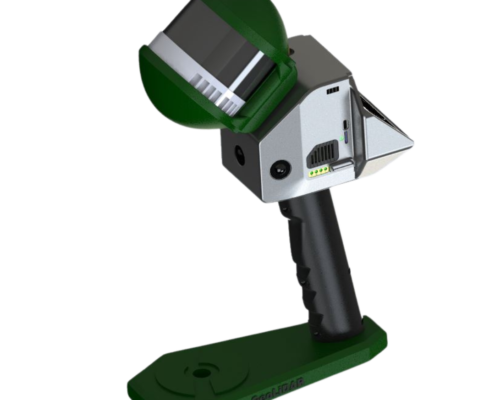
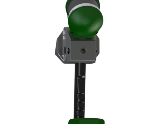
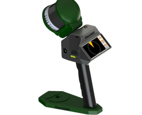
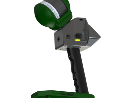
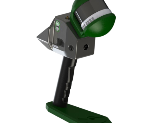
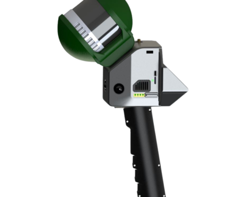
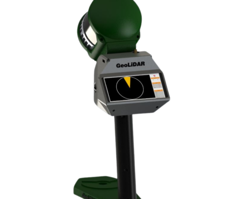
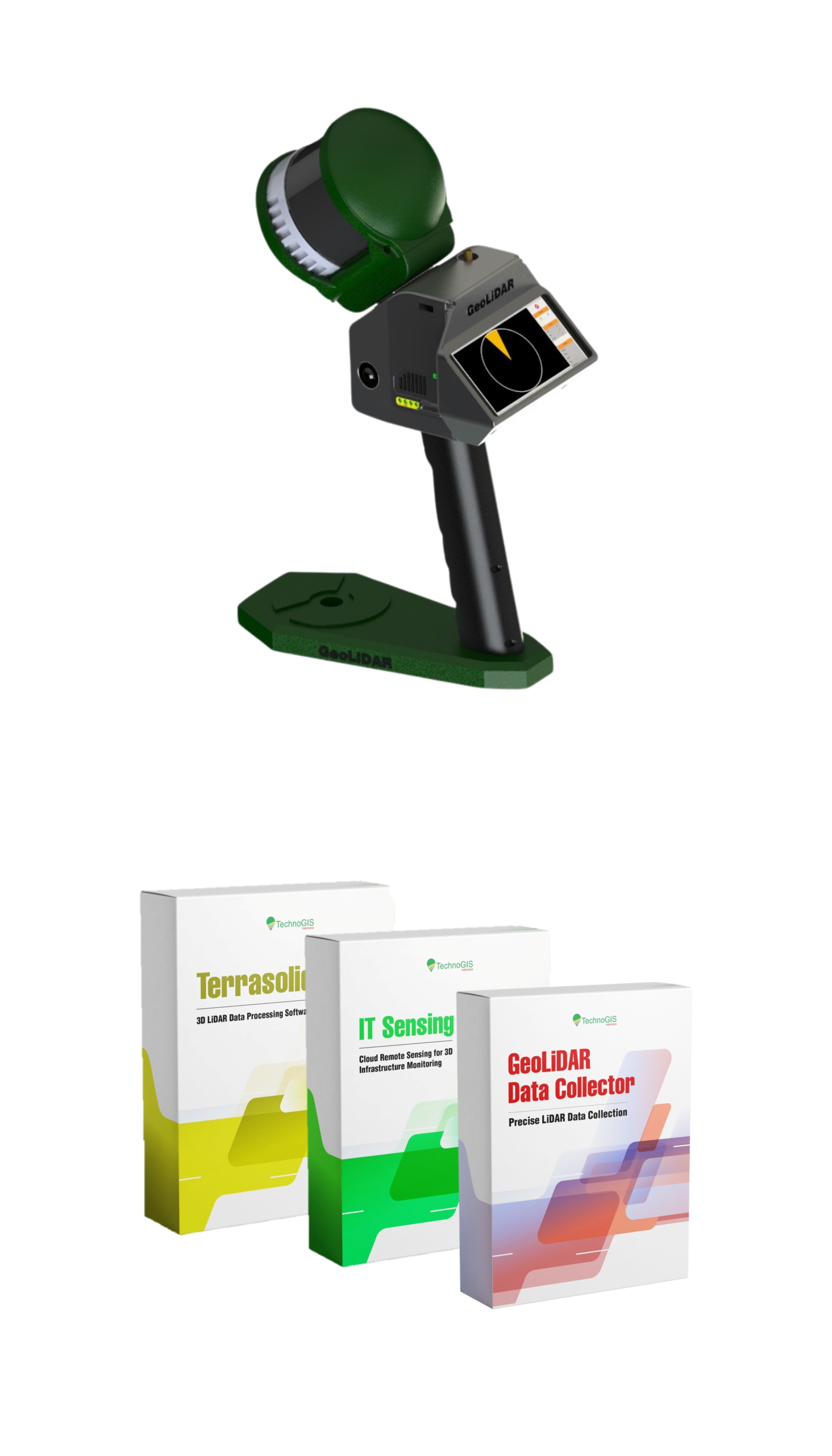
GeoLiDAR Handheld SLAM

The GeoLiDAR Handheld SLAM is an advanced mobile mapping solution designed to revolutionize data acquisition and processing in geospatial and environmental applications. Leveraging cutting-edge SLAM (Simultaneous Localization and Mapping) technology, this device delivers high-accuracy 3D mapping and geospatial data collection in real-time, even in GPS-denied environments.

The GeoLiDAR Laser Scanner proudly stands as Indonesia’s first LiDAR Equipment with a TKDN certification exceeding 25%, combining local excellence with global technology standards.

High Performance

Centi meters level accuracy with less than 5 second to fixed.

40 Working Hours

Industrial Lifepo4 battery for working along day without worries.

IoT Ready

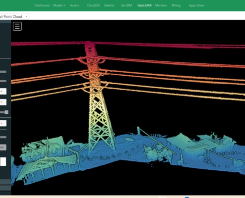
Stream data to TGIS dashboard realtime using cloud technology.

Lest talk about features

Keys & Main Feature

LiDAR type: 903 nm, 300.000 Point per second
Max Distance: 200 m
CPU: Core i3 Quad Core
Internal: 512 Gb

GNSS type: Multi Frequency GNSS with 184 Channel, GPS L1C/A L2C, GLO L1OF L2OF, GAL E1B/C E5b, BDS B1I B2I, QZSS L1C/A L2C.
GNSS Convergence time: RTK <10 sec.
Nav. update rate:
RTK up to 20 Hz1.
GNSS Position accuracy: RTK 0.01 m + 1 ppm.
Survey: Static, RTK Radio, RTK NTRIP, Navigation DGPS.

Indonesia TKDN: >25%.

  • Portability & Ergonomics: Lightweight and handheld, designed for ease of use in any terrain.
  • SLAM Technology: Accurately maps complex indoor and outdoor environments without GPS dependency.
  • Real-Time Processing: Visualize and process point cloud data instantly for faster decision-making.
  • High Precision: Captures fine details with millimeter-level accuracy.
  • Multi-Environment Adaptability: Performs seamlessly in forests, urban areas, caves, and industrial sites.
  • Cloud Integration: Direct integration with GeoLiDAR Cloud for enhanced data management and analysis

GeoLiDAR Handheld SLAM

The Future of 3D Mapping is in Your Hands

In the ever-evolving world of geospatial technology, precision and efficiency are paramount. The GeoLiDAR Handheld SLAM is a game-changing innovation designed to meet the growing demand for rapid, high-accuracy data collection in diverse environments. Whether you’re navigating dense forests, urban corridors, or underground tunnels, this compact and powerful device ensures seamless 3D mapping with unmatched reliability.

With the integration of advanced SLAM (Simultaneous Localization and Mapping) technology, GeoLiDAR Handheld SLAM eliminates the need for traditional GPS systems, making it the ideal solution for challenging environments where GPS signals are unavailable. Its cutting-edge features allow professionals to gather critical spatial data effortlessly, reducing the time and cost associated with conventional mapping methods.

TechnoGIS has crafted this device with user convenience and performance in mind. Combining portability, precision, and real-time processing, the GeoLiDAR Handheld SLAM sets a new benchmark in the geospatial industry. It empowers industries such as forestry, construction, mining, and urban planning to redefine their workflows and achieve unparalleled results.

1
2
3
4
1

Laser Sensor Rotary

2

5 Mp Camera

3

Handheld And Power Battery

4

Software Data Processing

GeoLiDAR
Channel 16 – 32 Channels
Wavelength ~300.000 points/second
Detection Measurement Range 903 nm
Field of View 200 Meters
3D LiDAR Data Points Generated Single Return Mode : ~300.000 point/second Dual Return Mode : ~ 600.000 point/second
Range of Accuracy 225° x 360° Automatic Rotation
Point Cloud Accuracy Scanning Up to ±3 cm (Typical) 5cm @100m
Rotation Rate 5 – 20 Hz
GNSS System Support Static Correction and NTRIP Correction GPS L1/L2/L5, GLONASS L1/L2 BDS B1C/B1/B2/B2a/B2b/B3 GALILEO E1/E5b/E5a
Position Accuracy Horizontal 0.02m and Vertical 0.05 m
Battery Power 22.2 V (6s)
Processor Intel Core I5
RAM 8 GB
Internal Storage SSD 512GB
Controller Personal Computer Outdoor
Operating Temperature -10°C to 60°C
Data Raw data : .dat and .gld Output : .las
*Camera Resolution 4 x 5 Megapixel
Dimensions H x W x D 120 mm x 145 mm x 220 mm
Weight 4.420 gram
TKDN (Tingkat Komponen Dalam Negeri) Certificate 40 %

Unlock Limitless Possibilities with GeoLiDAR Handheld SLAM
Revolutionize your mapping and data collection process with the GeoLiDAR Handheld SLAM, the ultimate tool for professionals in geospatial, construction, forestry, and beyond. Say goodbye to cumbersome equipment and time-consuming workflows—this lightweight, portable device combines cutting-edge SLAM technology with real-time processing, delivering accurate 3D maps in any environment. Whether you’re surveying dense forests, scanning underground tunnels, or analyzing urban landscapes, GeoLiDAR Handheld SLAM ensures precision and efficiency like never before.

Why Choose GeoLiDAR Handheld SLAM?

  • Efficient Workflow: Reduce time and labor costs with faster data collection and processing.
  • User-Friendly Interface: Intuitive controls and a seamless user experience for professionals and beginners alike.
  • Robust Build: Built to withstand challenging environments, ensuring durability and reliability.
  • Exceptional Support: Backed by TechnoGIS expertise, offering comprehensive training and customer support.

Your Next Breakthrough is Just One Scan Away

Experience the power of advanced technology tailored for your industry. With GeoLiDAR Handheld SLAM, you can transform complex projects into streamlined operations, saving time, reducing costs, and boosting productivity. Don’t let outdated methods hold you back—embrace innovation today and take your projects to the next level. Contact us now to schedule a demo and see how GeoLiDAR Handheld SLAM can redefine your workflow!

Lest talk about features

Keys & Main Feature

  • Surveying and Mapping: Deliver accurate land surveys and topographical maps with confidence.
  • Construction: Ensure precise measurements and layouts for efficient project execution.
  • Agriculture: Enhance crop management with precise geolocation for smart farming.
  • Environmental Monitoring: Support data collection for conservation and analysis with reliable positioning.
No Details Date Type
1 Manual Books  20/12/2024 pdf
2 Feature Eksplanation 21/12/2024 pdf
3 Design and Technology 22/12/2024 pdf
4 Research Publication 23/12/2024 pdf
5 Certificate Calibration 24/12/2024 pdf
6 Result of Calibration 25/12/2024 pdf
7 Sampel Data Location 1 25/12/2024 pdf
8 Sampel Data Location 2 25/12/2024 pdf
9 Sampel Data Location 3 25/12/2024 pdf
10 GeoLiDAR Data Collector 25/12/2024 exe
11 GeoLiDAR Post Processing Software 25/12/2024 exe

Utilization of GeoLiDAR SLAM First Case

Forestry and Environmental Monitoring

The GeoLiDAR Handheld SLAM transforms forest management by enabling accurate measurement of tree height, canopy density, and biomass. Its ability to work seamlessly in dense, GPS-restricted environments ensures comprehensive data collection for carbon stock estimation and reforestation projects. This device supports conservation efforts and enhances environmental monitoring, empowering researchers and organizations to make informed decisions.

Advanced Construction Monitoring

Construction and Infrastructure Development

Efficiently manage construction projects with precise as-built documentation, site surveys, and progress tracking. The GeoLiDAR Handheld SLAM captures detailed 3D scans of construction sites, identifying discrepancies between design plans and on-site conditions. Its real-time processing capability accelerates decision-making, ensuring that projects are completed on time and within budget.

Green Energy and Smart Mining

Mining and Underground Mapping

GeoLiDAR Handheld SLAM is an invaluable tool for mining operations, particularly in underground environments where GPS is unavailable. It enables detailed mapping of tunnels, caverns, and mine shafts, ensuring safety and operational efficiency. By providing accurate spatial data, it aids in resource estimation, structural analysis, and hazard identification, optimizing mining workflows.

Smart Planning Management

Urban Planning and Disaster Management

Enhance urban planning initiatives with the GeoLiDAR Handheld SLAM’s high-precision data collection. It facilitates infrastructure assessment, smart city development, and disaster mitigation planning. During emergencies, such as earthquakes or floods, the device provides rapid and reliable mapping of affected areas, helping authorities to prioritize rescue and recovery efforts effectively.

GeoLiDAR for Environment Issue

Heritage Preservation and Archaeology

Preserve historical and cultural landmarks with precision using the GeoLiDAR Handheld SLAM. Its ability to capture intricate details in 3D ensures accurate documentation and digital archiving of heritage sites. Archaeologists can use the device to reconstruct ancient structures, analyze excavation sites, and create virtual models, safeguarding invaluable cultural assets for future generations.