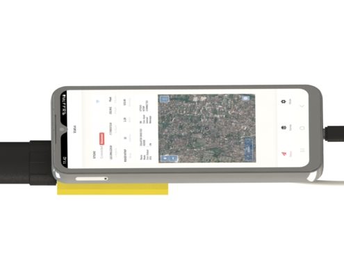
Low Cost Rover GNSS Module

TGS GNSS N2 Mobile Rover

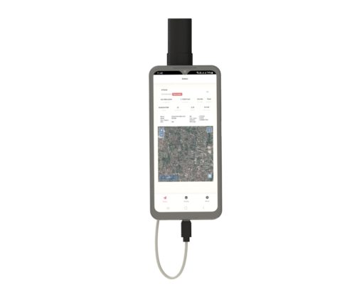
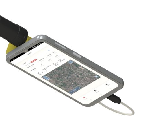
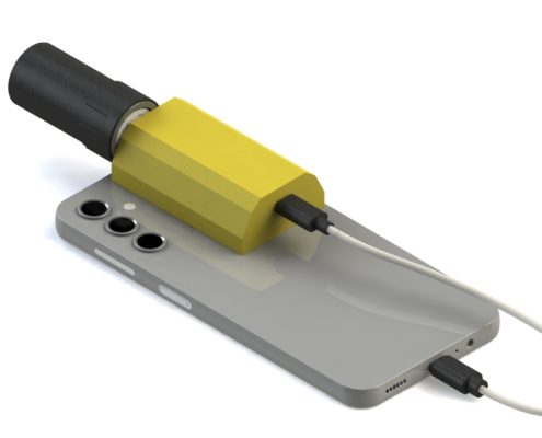
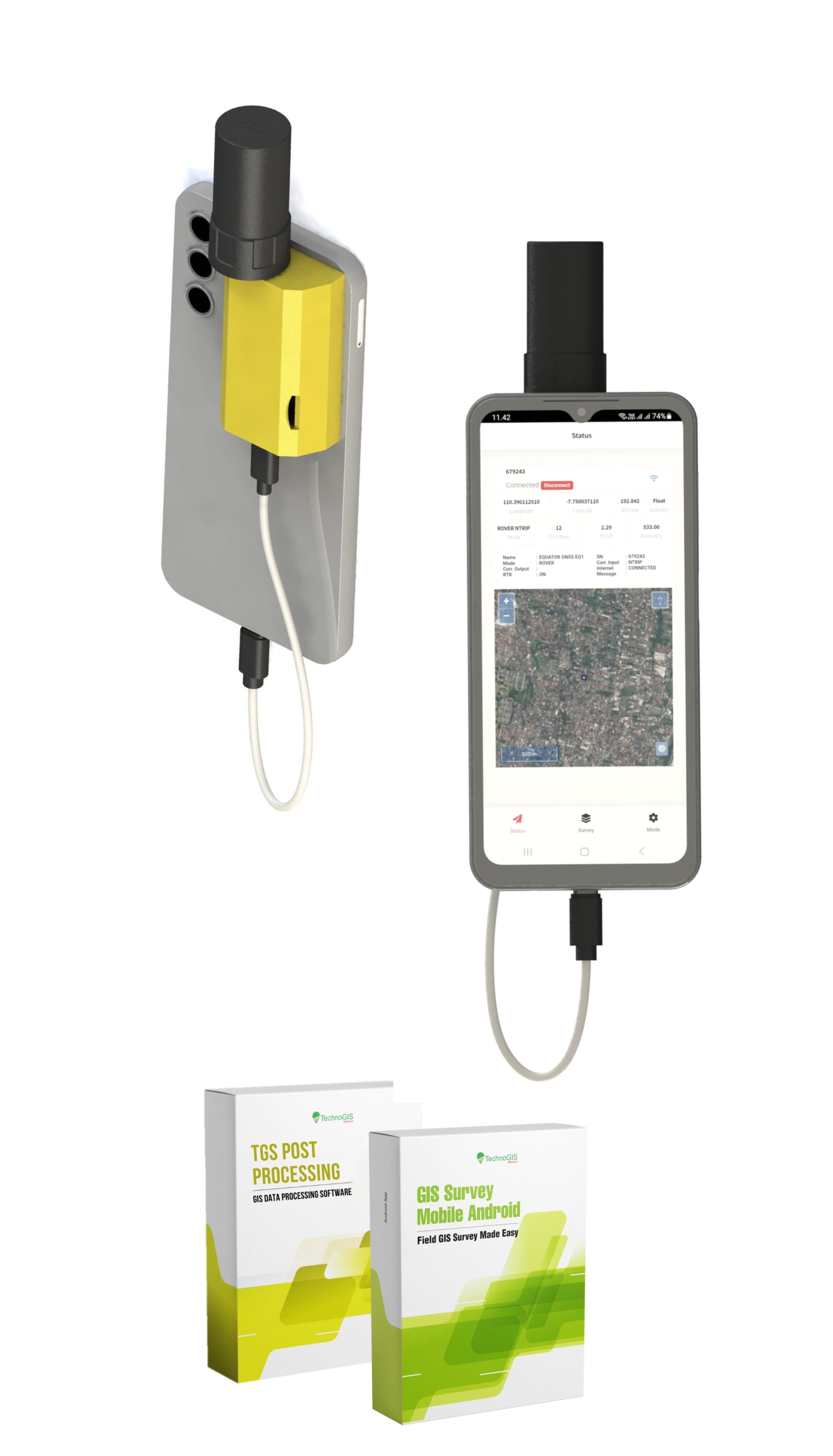
The TGS GNSS N Series is a cutting-edge mobile rover RTK device, designed for seamless integration with mobile devices and RTK NTRIP connections. This state-of-the-art system ensures centimeter-level positioning accuracy, making it an ideal solution for professionals in surveying, mapping, and geospatial applications.

The TGS GNSS RTK’s Indonesia’s first GNSS Geodetic with a TKDN certification exceeding 25%, combining local excellence with global technology standards.

High Performance

Centi meters level accuracy with less than 5 second to fixed.

Ultra Low Power

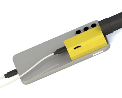
Working with power from mobile with type c USB

IoT Ready

Stream data to TGIS dashboard realtime using cloud technology.

Lest talk about features

Keys & Main Feature

Receiver type: Multi Frequency GNSS with 184 Channel, GPS L1C/A L2C, GLO L1OF L2OF, GAL E1B/C E5b, BDS B1I B2I, QZSS L1C/A L2C.

Convergence time: RTK <10 sec.
Nav. update rate:
RTK up to 20 Hz1.
Position accuracy: RTK 0.01 m + 1 ppm.

Survey: Static, RTK NTRIP, Navigation DGPS.

Indonesia TKDN: >25%.

The TGS GNSS N Series is a revolutionary mobile rover RTK device, meticulously designed to provide unparalleled centimeter-level accuracy, ensuring that geospatial professionals can achieve exceptional precision in their mapping and surveying projects, regardless of environmental challenges.

Seamlessly integrating with mobile devices and leveraging advanced RTK NTRIP technology, the TGS GNSS N Series redefines convenience and efficiency by delivering real-time positioning solutions that empower users to collect, process, and analyze data faster than ever before.s.

With its robust compatibility with the GIS Survey Mobile Application, the TGS GNSS N Series transforms fieldwork into a streamlined, high-performance experience, enabling professionals to visualize and manage geospatial data with unparalleled accuracy and ease.

TGS GNSS N Series

High-Precision Mobile Rover RTK Solution

In the fast-evolving world of geospatial technology, achieving accurate and reliable positioning is critical for success. The TGS GNSS N Series sets a new standard in precision and portability, offering a robust solution for professionals seeking dependable centimeter-level accuracy in the field. Whether you’re working on land surveying, mapping, or agricultural projects, this innovative device is designed to meet the diverse needs of modern geospatial applications.

With an increasing demand for mobile-friendly and real-time positioning systems, the TGS GNSS N Series bridges the gap between advanced technology and user convenience. Its seamless integration with mobile devices and RTK NTRIP connections ensures that users can perform tasks more efficiently without compromising on accuracy or reliability. This solution empowers professionals to make informed decisions based on precise geospatial data.

Built for adaptability and performance, the TGS GNSS N Series is more than just a positioning tool—it’s a comprehensive system tailored to enhance productivity in various industries. Its compatibility with GIS Survey Mobile App further extends its functionality, making it an indispensable asset for professionals who value precision and efficiency in their workflows.

1
2
3
4
5
6
1

GNSS Antenna

2

GNSS Module N Series

3

Standing Pool

4

Mobile Android/IOS

5

TGS Post Processing

6

GIS Survey Mobile

GNSS Signal
Number Of Channel 1507
BDS-2 B1I, B2I,B3I
BDS-3 B1I, B1C, B2a, B2b (PPP), B3I
GPS L1 C/A, L1C, L2, L5
GLO G1,G2
GAL E1,E5a, E5b, E6*
QZSS L1C/A, L1C, L2, L5, L6*
NavIC (IRNSS) L5
SBAS* L1C/A
Data
Data Format CMR, CMR+, RTCM 2.x, RTCM 3.x
Data Output NMEA-0183, RINEX, TXT, TGS
Data Update GNSS Observation Up to 50Hz
Data Update GNSS Position Result 5Hz
Cold Start <30 s
Hot Start < 5s
Communication
Bluetooth V4.0
Wifi 802.11 a/b/g/n/ac
Storage 32 GB
Internal Radio 410~470MHz
Data cabel RS232
Positioning Performance
Real Time Kinematic Horizontal Positioning Accuracy 10m +1 ppm (RMS) Vertical Positioning Accuracy 15 mm +1 ppm (RMS)
High-Precission Static Horizontal Positioning Accuracy 5 mm +1 ppm (RMS) Vertical Positioning Accuracy 10 mm +1 ppm (RMS)
Single Point Horizontal Positioning Accuracy 1.5 m +1 ppm (RMS) Vertical Positioning Accuracy 2.5 m +1 ppm (RMS)
RTK Initialization <5s
Timming Accuracy 20ns (RMS)
Power
Battery 7.4V, 7000mAh Li-Ion Rechargerable,
Operating Time RTK Rover Up to 8 Hours Static Mode Up to 12 Hours
Charger Support charging adapter 12V/1.5A
Physical
Dimension (W x H) Diameter160 mm x 100 mm
Weight 1050 gram
TKDN (Tingkat Komponen Dalam Negeri) Certificate 38%

Designed to meet the rigorous demands of industries like construction, agriculture, and infrastructure management, the TGS GNSS N Series offers a cost-effective solution that combines cutting-edge technology with a user-friendly interface, making it the perfect tool for field operations of any scale.

Applications of TGS GNSS N Series:

1. Land Surveying:
Achieve centimeter-level precision for boundary mapping, topographic surveys, and cadastral documentation. The TGS GNSS N Series streamlines workflows, enabling faster and more accurate survey results.

2. Construction and Engineering:
Optimize project execution with precise geospatial data for site preparation, infrastructure alignment, and as-built verifications. The TGS GNSS N Series ensures accuracy in every phase of construction.

3. Precision Agriculture:
Enhance agricultural productivity with precise field mapping, automated machinery guidance, and variable rate applications. The TGS GNSS N Series supports sustainable farming practices through accurate resource management.

4. Urban Planning and GIS Mapping:
Create detailed geospatial datasets for urban development, utility mapping, and disaster risk management. The TGS GNSS N Series integrates seamlessly with GIS platforms, providing real-time data for informed planning.

5. Mining and Quarrying:
Streamline resource exploration, pit design, and volume calculations with high-accuracy GNSS positioning. The TGS GNSS N Series is built to withstand rugged mining environments while maintaining reliable performance.

Embrace the precision and reliability of the The TGS GNSS N Series and elevate your geospatial projects to new heights.

Lest talk about features

All documents about TGS EQ1 GNSS

  • Surveying and Mapping: Deliver accurate land surveys and topographical maps with confidence.
  • Construction: Ensure precise measurements and layouts for efficient project execution.
  • Agriculture: Enhance crop management with precise geolocation for smart farming.
  • Environmental Monitoring: Support data collection for conservation and analysis with reliable positioning.
No Details Date Type
1 Manual Books  20/12/2024 pdf
2 Feature Eksplanation 21/12/2024 pdf
3 Design and Technology 22/12/2024 pdf
4 Research Publication 23/12/2024 pdf
5 Certificate Calibration 24/12/2024 pdf
6 Result of Calibration 25/12/2024 pdf
7 Sampel Data Location 1 25/12/2024 pdf
8 Sampel Data Location 2 25/12/2024 pdf
9 Sampel Data Location 3 25/12/2024 pdf
10 TGS Post Processing 25/12/2024 exe
11 NiVO Ground Control 25/12/2024 exe

TGS GNSS EQ1 RTK First Case

Utilization for High-Precision Mapping and Surveying

TGS GNSS EQ1 RTK provides centimeter-level accuracy for mapping and surveying, ensuring reliable georeferencing in challenging environments. It is widely used for land surveys, topographic mapping, and creating digital elevation models, improving the quality and precision of geospatial data for various applications.

Advanced GPS GeodeticTechniques

Using TGS GNSS EQ1 RTK for Spatial Analysis and Infrastructure Planning.

TGS GNSS EQ1 RTK supports advanced geodetic techniques for spatial analysis and infrastructure planning by delivering precise positioning data. It helps in urban planning, road construction, and resource management, ensuring accurate mapping, alignment, and optimization of large-scale infrastructure projects.

integrating TGS GNSS EQ1 RTK

TGS GNSS RTK: Revolutionizing Precision in Road Surveys

The TGS GNSS RTK is a cutting-edge solution for road surveys, offering unparalleled accuracy and efficiency. With Real-Time Kinematic (RTK) technology, it ensures centimeter-level precision in mapping road alignments, boundaries, and features. Engineered for robust performance in diverse terrains, the TGS GNSS RTK streamlines data collection for transportation planning and infrastructure development, making it an essential tool for road survey professionals.

TGS GNSS EQ1 RTK Applications

Basemark BM, GCP, ICP Setup for Accurate Spatial Referencing.

TGS GNSS EQ1 RTK is crucial for establishing accurate basemarks that serve as reliable reference points for spatial data collection. It ensures precise coordinates for geodetic networks and surveying, supporting consistent and accurate data across large-scale projects like construction and infrastructure development.

Cadastral Mapping with RTK

TGS GNSS EQ1 RTK to Provide Accurate Percil for Cadastral Border

The TGS GNSS EQ1 RTK is an advanced solution for precise cadastral border mapping. Utilizing Real-Time Kinematic (RTK) technology, this device delivers centimeter-level accuracy, ensuring reliability in defining land boundaries. Designed for efficiency and ease of use, the TGS GNSS EQ1 RTK is the ideal choice for land surveying and geospatial data management.