TechnoGIS Signs Strategic MoU at GeoConnect Asia 2025 to Boost Regional Geospatial Collaboration
TechnoGIS Signs Strategic MoU at GeoConnect Asia 2025 to Boost Regional Geospatial Collaboration
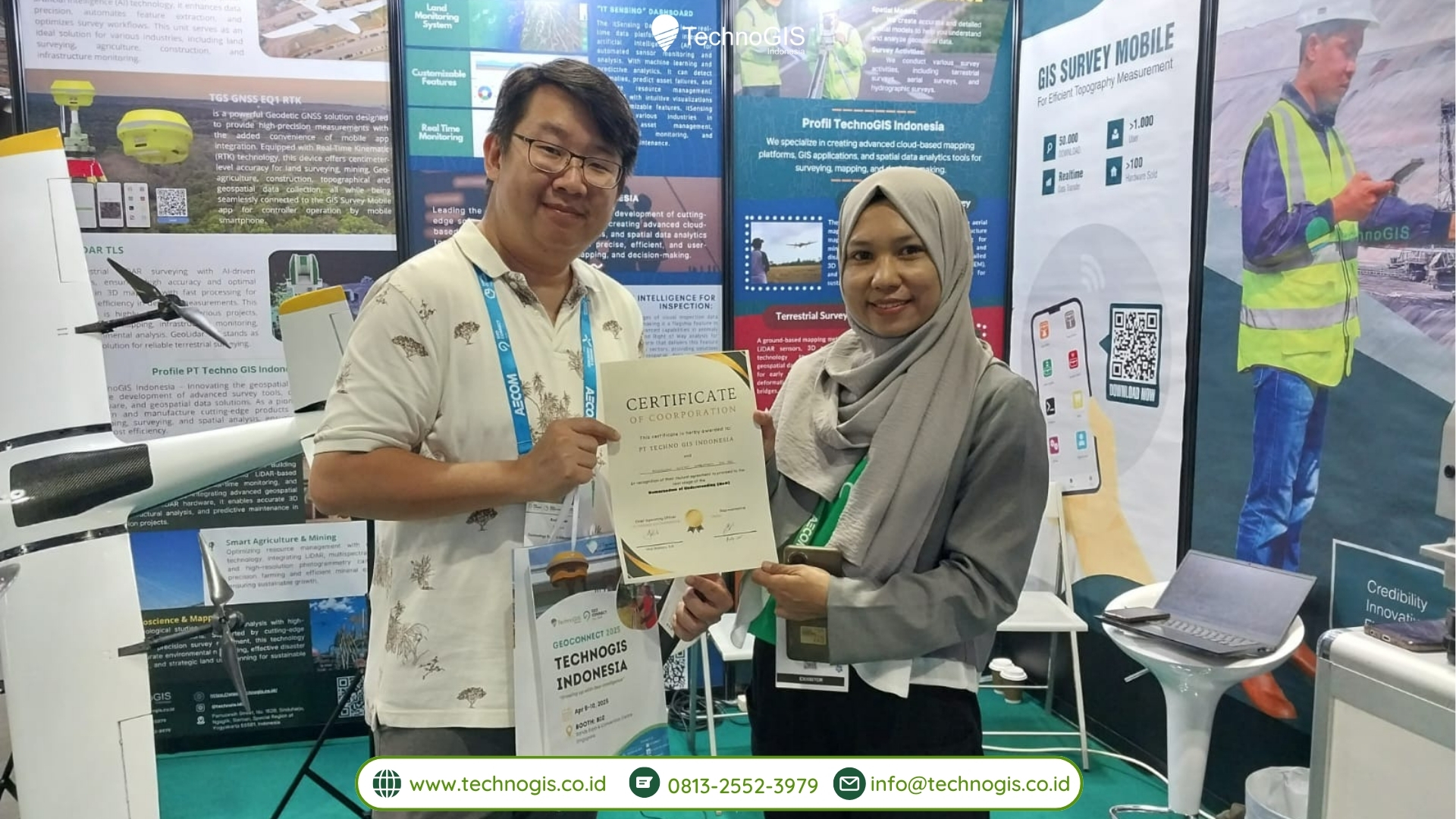
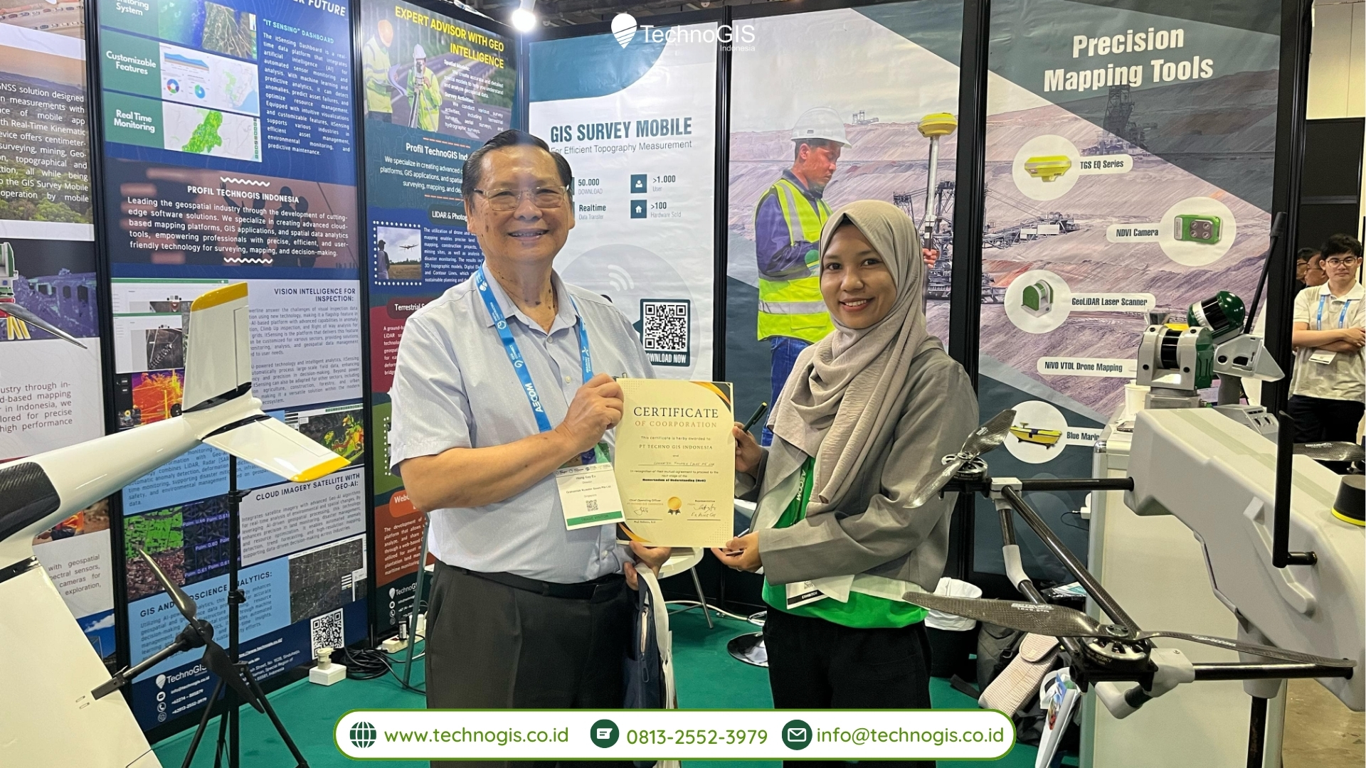
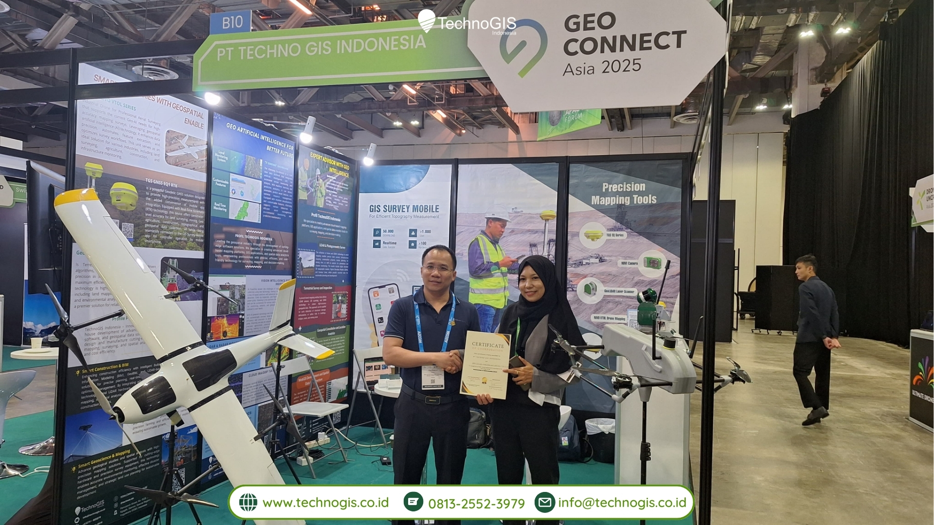
Singapore, April 10, 2025 — PT TechnoGIS Indonesia, a leading player in the Indonesian geospatial industry, marked a significant milestone during its participation at GeoConnect Asia 2025, held from April 9–10, 2025, at the Sands Expo & Convention Centre, Singapore. Amidst the dynamic atmosphere of the region’s premier geospatial and location intelligence event, TechnoGIS signed a series of Strategic Memoranda of Understanding (MoUs) with several notable international companies. These agreements aim to foster long-term collaboration and innovation in geospatial technology and services across Southeast Asia and beyond.
The companies that formalized their partnerships with TechnoGIS during the event include:
-
Technology System Integration (TSI) – a tech-forward solutions integrator in advanced GIS platforms
-
GrahamTek Nuwater SPORE PIE – a Singapore-based sustainable water and infrastructure technology provider
-
Nam Ha Noi Cadastral and Construction – a Vietnamese state-aligned entity in urban planning and land administration
A Step Toward Regional Integration
The signing of these MoUs reflects TechnoGIS’s ambition to expand its footprint beyond Indonesia and build collaborative ecosystems with international stakeholders in the geospatial field. According to Mrs. Muji Rahayu, Director Operational of TechnoGIS Indonesia, these partnerships are a strategic move to encourage shared research, technology transfer, and joint projects focused on land management, smart city infrastructure, and environmental sustainability.
The Partners and Collaborative Vision
1. Technology System Integration (TSI)
TSI specializes in developing integrated systems for real-time geospatial data analysis and visualization. The collaboration with TechnoGIS is projected to focus on building end-to-end geospatial platforms for asset management, infrastructure monitoring, and disaster mitigation.
Through this MoU, both companies will co-develop Geo-AI solutions that harness artificial intelligence for land use planning, urban risk detection, and energy asset tracking — solutions that are especially relevant in Indonesia’s fast-growing infrastructure sector.
2. GrahamTek Nuwater SPORE PIE
GrahamTek is recognized for its cutting-edge water purification systems and sustainability technologies. The MoU with TechnoGIS is expected to explore the integration of geospatial data with environmental and hydrological modeling. By combining TechnoGIS’s mapping capabilities with GrahamTek’s water technologies, the collaboration aims to support urban water resilience, especially in areas vulnerable to flooding and groundwater depletion.
This initiative is also aligned with Smart City development efforts in Southeast Asia, where geospatial input is critical for infrastructure planning and environmental monitoring.
3. Nam Ha Noi Cadastral and Construction
As one of Vietnam’s leading cadastral and urban construction entities, Nam Ha Noi brings experience in land registry modernization and spatial planning systems. The partnership with TechnoGIS will focus on knowledge sharing, capacity building, and potentially pilot projects involving land parcel mapping and automated boundary detection using remote sensing technologies.
This cross-border cooperation is a promising step toward creating regional standards in digital land administration, opening pathways to digital cadastre systems that are interoperable across ASEAN member states.
Participation in GeoConnect Asia 2025
TechnoGIS’s involvement in GeoConnect Asia 2025 was not limited to MoU signings. The company also showcased its latest innovations, including:
-
GeoLiDAR ALS – an airborne LiDAR system supporting high-precision mapping
-
NiVO Series Drones – tailored for topographic surveys, infrastructure inspections, and environmental monitoring
-
TGS Platform – a modular software for asset inventory and geospatial data management, now being deployed by clients in energy, utility, and forestry sectors
At their booth, TechnoGIS demonstrated real-time asset monitoring applications and discussed local content development (TKDN) initiatives to support national industries.
“We’re proud to bring not just our products but also our commitment to innovation and collaboration. This event allowed us to meet potential clients, partners, and governments who share the same vision — using geospatial intelligence for sustainable development,” said Azza, TechnoGIS’s Business Development Coordinator.
Looking Forward: A Platform for Global Collaboration
The MoUs signed at GeoConnect Asia 2025 are part of TechnoGIS’s broader mission to elevate Indonesia’s geospatial technology to the international stage. By collaborating with companies in Singapore, Vietnam, and other regional hubs, TechnoGIS seeks to promote cross-border innovation, standardized mapping practices, and joint research initiatives.
These partnerships are also expected to open doors for tech transfer, capacity building programs, and regional pilot projects in smart infrastructure, climate resilience, and digital cadastral modernization.
“We believe this is just the beginning. TechnoGIS is open and ready to partner with more international companies who share our values of precision, sustainability, and innovation. With these MoUs, we’re building a bridge — not just between companies, but between nations,” added Mr. Sarono in closing.
Conclusion
GeoConnect Asia 2025 served as a pivotal platform for TechnoGIS to establish itself as a regional leader in geospatial services. Through strategic MoUs with Technology System Integration, GrahamTek Nuwater SPORE PIE, and Nam Ha Noi Cadastral and Construction, TechnoGIS has laid the foundation for meaningful, forward-looking collaboration.
These agreements signal a new chapter — one where international cooperation and geospatial integration take center stage in solving pressing challenges in urban planning, environmental protection, and digital infrastructure development.
As TechnoGIS continues its journey, the message is clear: geospatial innovation knows no borders — and collaboration is the compass that will guide the way forward.
