High Performance Drone for Geospatial

NiVO Quadrone Pro

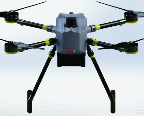
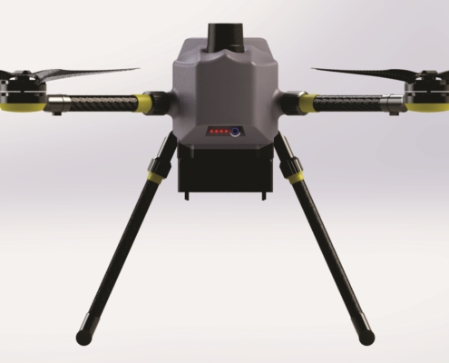
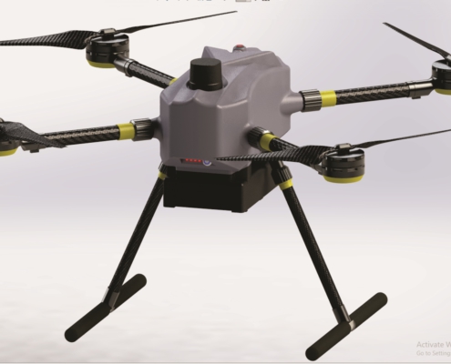
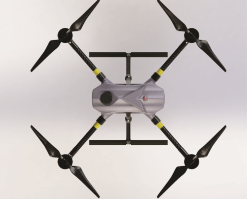
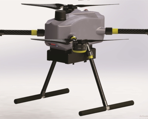
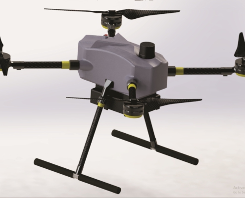
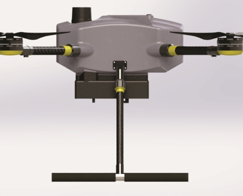
NiVO Quadrone Pro is a professional-grade drone specifically designed for mapping, remote sensing, and high-precision 3D modeling. With its built-in LiDAR system, NiVO Quadrone Pro delivers unparalleled efficiency and accuracy for applications such as land surveying, infrastructure mapping, forestry, mining, and disaster management.

The NiVO proudly stands as Indonesia’s technologies drone with a TKDN certification exceeding 25%, combining local excellence with global technology standards.

High Performance

Aerial Mapping with RTK or PPK high accuracy GNSS.

55 Minute Endurance

Long range mapping max 55 minute for mapping.

IoT Ready

Stream data to TGIS dashboard realtime using cloud technology.

Lest talk about features

Keys & Main Feature

NiVO Quadrone Pro redefines industrial drone technology by delivering high-performance aerial solutions that ensure precision, efficiency, and reliability for every mission, no matter the scale or complexity.

Span: 1200 mm
Flightime: +-55 minutes
Max Takeoff: 1,5 kg
Max Payload: 750 gram
Cruise: 8 m/s
Payload: RGB Camera, LiDAR, Multispectral Camera

GNSS type: Multi Frequency GNSS with 184 Channel, GPS L1C/A L2C, GLO L1OF L2OF, GAL E1B/C E5b, BDS B1I B2I, QZSS L1C/A L2C.
GNSS Convergence time: RTK <10 sec.
Nav. update rate:
RTK up to 20 Hz1.
GNSS Position accuracy: RTK 0.01 m + 1 ppm.

Indonesia TKDN: >25%.

Integrated LiDAR System
NiVO Quadrone Pro features an integrated LiDAR sensor, enabling fast and detailed data collection without external devices. With up to ±2 cm accuracy, it excels in capturing precise data, even in complex and hard-to-reach terrains.

Rugged Design and Long Flight Time
Its rugged modular design ensures easy maintenance and durability, with an IP65-rated body for extreme conditions. With a 55-minute flight time, it covers large areas efficiently, minimizing downtime for battery changes.

Real-Time Processing and AI 3D Modeling
The drone’s real-time data processing delivers instant mapping results, cutting post-flight work. Integrated AI technology supports precise 3D modeling, ideal for industries like civil engineering and forestry requiring detailed spatial analysis.

Stable Multi-Band Connectivity
Equipped with multi-band communication, NiVO Quadrone Pro offers stable connections up to 15 km, ensuring seamless operations even in remote or densely vegetated areas.

NiVO Quadrone Pro

The Ultimate Solution for Mapping and Remote Sensing with Cutting-Edge Technology

In an era where precision and efficiency are paramount, NiVO Quadrone Pro redefines how professionals approach mapping and remote sensing tasks. This advanced drone integrates the latest technologies to deliver seamless data acquisition and analysis, empowering industries to make better-informed decisions faster than ever before.

Whether you are surveying rugged terrains, managing natural resources, or conducting infrastructure inspections, NiVO Quadrone Pro offers unmatched performance tailored to your needs. Designed with both functionality and reliability in mind, this drone ensures accuracy and dependability, even in the most challenging environments.

Built for professionals across various sectors, NiVO Quadrone Pro combines cutting-edge innovation with user-friendly operation. With a focus on durability, high precision, and advanced data integration, this drone sets the standard for modern mapping technology.

1
2
3
4
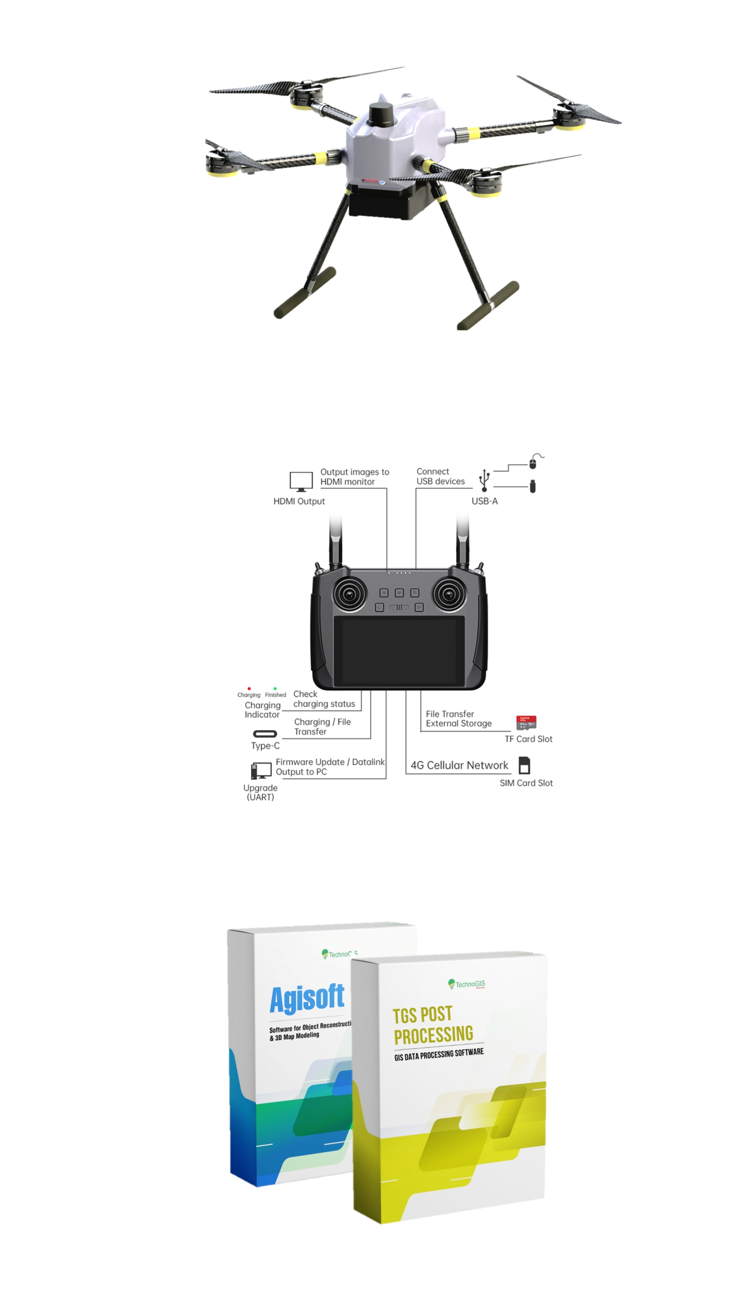
1

NiVO Quadrone Aircraft

2

Smart Remote Control

3

Agisoft Metashape

4

TGS Post Processing

Industrial Drone Mapping Quadrone Pro
Body
Material Carbon, Alloy, Alumunium, Composite fiberglass
Propeller VTOL 1860 Carbon Fiber
  Endurance 30 Minutes
Unit Performance
Speed Mission 5 – 10 m/s
Coverage Area Mapping 50 Ha
Takeoff weight 3200 gram
Payload 1000 gram
Battery Li-ion Pollymer 22.2 V
Power
Capacity 16000 mAh
Flight Planner QGC or Mission Planner
GNSS PPK/ RTK System
GNSS Type Dual Frequency
Accuracy absolute Horizontal : 10 cm Vertical : 15 cm
   
TKDN (Tingkat Komponen Dalam Negeri) Certificate >25%
     
*Compatible Sensors
Camera High Resolution RGB 24 – 42 Mp (PPK Support)
Camera Thermal DRI Ranges Thermal Cahnnel
LiDAR For Mapping 720.000 point/second
Camera Multispectral Multi band
Camera For Inspection 6x up to 30x ZoomStabilized

Take your mapping and remote sensing projects to the next level with NiVO Quadrone Pro. Designed for professionals who demand accuracy and reliability, this drone delivers advanced features that simplify complex operations. Whether you’re working on land surveys, infrastructure inspections, or natural resource management, NiVO Quadrone Pro ensures every mission is efficient, precise, and hassle-free.

Invest in a drone that grows with your needs. With its integrated LiDAR technology, real-time data processing, and rugged design, NiVO Quadrone Pro offers an unmatched return on investment. This cutting-edge solution is not just a tool—it’s a partner in delivering accurate, high-quality results for your most challenging projects. Take the leap and discover why industry leaders are choosing NiVO Quadrone Pro.

Don’t wait to experience the future of mapping technology. Contact us now for a free consultation or a live product demonstration. Let us help you unlock the full potential of your operations with NiVO Quadrone Pro—the smarter, more efficient solution for modern mapping. Be ahead of the curve—order yours today!

All documents may you need

Documentation

NiVO Quadrone is a trusted tool for industries requiring high-precision data collection. Its proven reliability, compact design, and ease of use make it an excellent choice for professionals in demanding environments. Compliance with international standards ensures smooth integration into workflows, while its eco-friendly battery system reduces the carbon footprint. By offering exceptional value with superior performance, NiVO Quadrone is a smart investment for industries looking to modernize their operations.

No Details Date Type
1 Manual Books  20/12/2024 pdf
2 Feature Eksplanation 21/12/2024 pdf
3 Design and Technology 22/12/2024 pdf
4 Research Publication 23/12/2024 pdf
5 Certificate Calibration 24/12/2024 pdf
6 Result of Calibration 25/12/2024 pdf
7 Sampel Data Location 1 25/12/2024 pdf
8 Sampel Data Location 2 25/12/2024 pdf
9 Sampel Data Location 3 25/12/2024 pdf
10 TGS Post Processing 25/12/2024 exe
11 NiVO Ground Control 25/12/2024 exe

NiVO Drone First Case

PTSL / Land Administration Mapping

NiVO provides precise geospatial data critical for PTSL (Complete Systematic Land Registration) and land administration projects. With high-resolution aerial imagery, NiVO ensures accurate boundary mapping, reduces disputes, and accelerates land titling processes, supporting government and private initiatives.

Agriculture for Food Estate

Mapping for Paddy Field Design or New Land Investigation Surveys

Transforming potential land into productive agricultural areas demands detailed planning. NiVO excels in surveying and investigating new paddy field designs, offering detailed topographic data and visualizations that optimize land use and irrigation planning.

Mining & Energy

Mining Exploration, Maintenance and Analytical

Mining exploration requires precise and up-to-date information to minimize environmental impact. NiVO’s ability to map vast forested areas and monitor land transitions ensures compliance with regulations while facilitating responsible resource extraction.

Smart and Precision Agriculture

Plantation Mapping: Palm Oil Tree Counting, NDVI, and Plant Health Estimation

NiVO delivers comprehensive plantation monitoring, including tree counting, Normalized Difference Vegetation Index (NDVI) analysis, and plant health estimation. These features empower plantation managers to maximize yield, detect early signs of stress, and implement sustainable practices for palm oil cultivation.

Drone for Environment Issue

Coastal Line Mapping with Drone

NiVO’s aerial imaging capabilities are ideal for coastal line surveys, providing high-accuracy mapping of shorelines and their dynamics. This data is crucial for environmental monitoring, disaster mitigation, and coastal infrastructure planning, ensuring long-term sustainability and protection of marine ecosystems.