Call: +62274 – 885879
Chat : +62813-2552-3979
Mail :
[email protected]
Equator GNSS | GeoLiDAR | NiVO Drone | Blue Marine | Landcam
0
Shopping Cart
Home
About
About TechnoGIS
Our Awesome Team
Partners & Networks
Look at GIS & Geographic Insight
3 Keys Our Focus for Innovation
Social Responsibility
Contact
Software
GIS Survey Mobile
TGIS Cloud Dashboard
TGS Post Processing
iTSensing Cloud Image Processing
Instruments
TGS Low Cost RTK Reciever
NiVO VTOL Drone Mapping
Blue Marine Echosounder
GeoLiDAR Laser Scanner
Landcam Multispectral Camera
Solutions
CadGIS – Cadastral & Civil
TaniGIS – Agriculture
MinerGIS – Mining & Energy
DisasGIS – Disaster & Hazard
WisataGIS – Tourism Manage
DesaGIS – Urban Planning
BisnGIS – Geo Business Tools
NavnGIS – Navigation & Tracker
AtmosGIS – Climate & Weather
DefenGIS – Geo Military Defence
CarbonPlot – Carbon Balancing System
News & Updates
Academic
Online Webinar
Short Course & Training
Certification
Store
Login
Menu
Menu
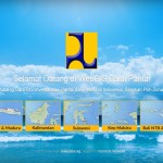
WebGIS Balaipantai Kementrian PU
Pelatihan GIS Basic Mahasiswa Geografi UGM
Scroll to top

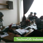 Pelatihan GIS Basic Mahasiswa Geografi UGM