Tag Archive for: #IndustrialTransformation

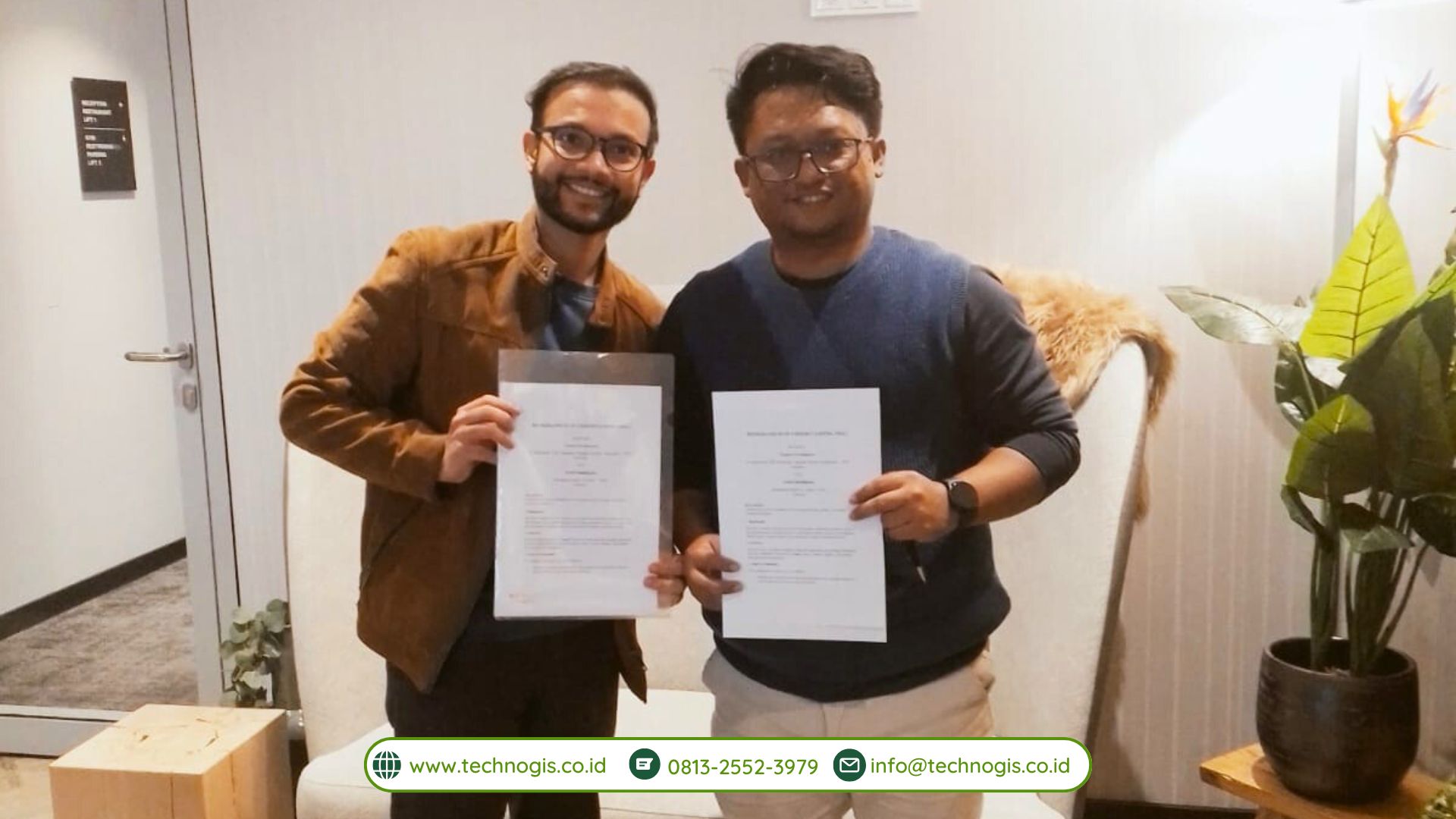
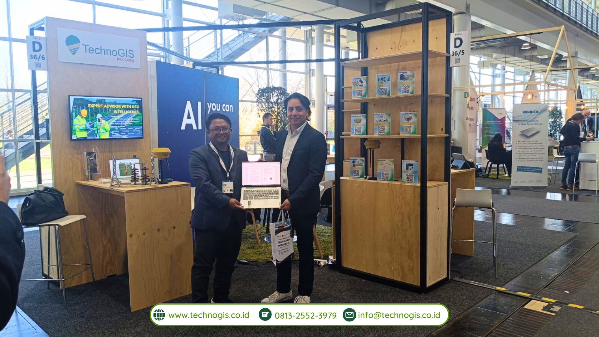
PT Techno GIS Indonesia and Taskility Forge Partnership at Hannover Messe 2025, Marking a New Era in Mapping Technology Innovation

Hannover, Germany – In a remarkable development at Hannover Messe 2025, PT Techno GIS Indonesia and Taskility, a technology firm based in Mexico, officially signed a Memorandum of Understanding (MoU) solidifying their commitment to collaborate on innovative mapping technology solutions. This strategic alliance not only underscores the global reach of both companies but also marks a significant milestone in the broader context of advancing digital innovation at an international level.

A Meeting of Minds in Hannover
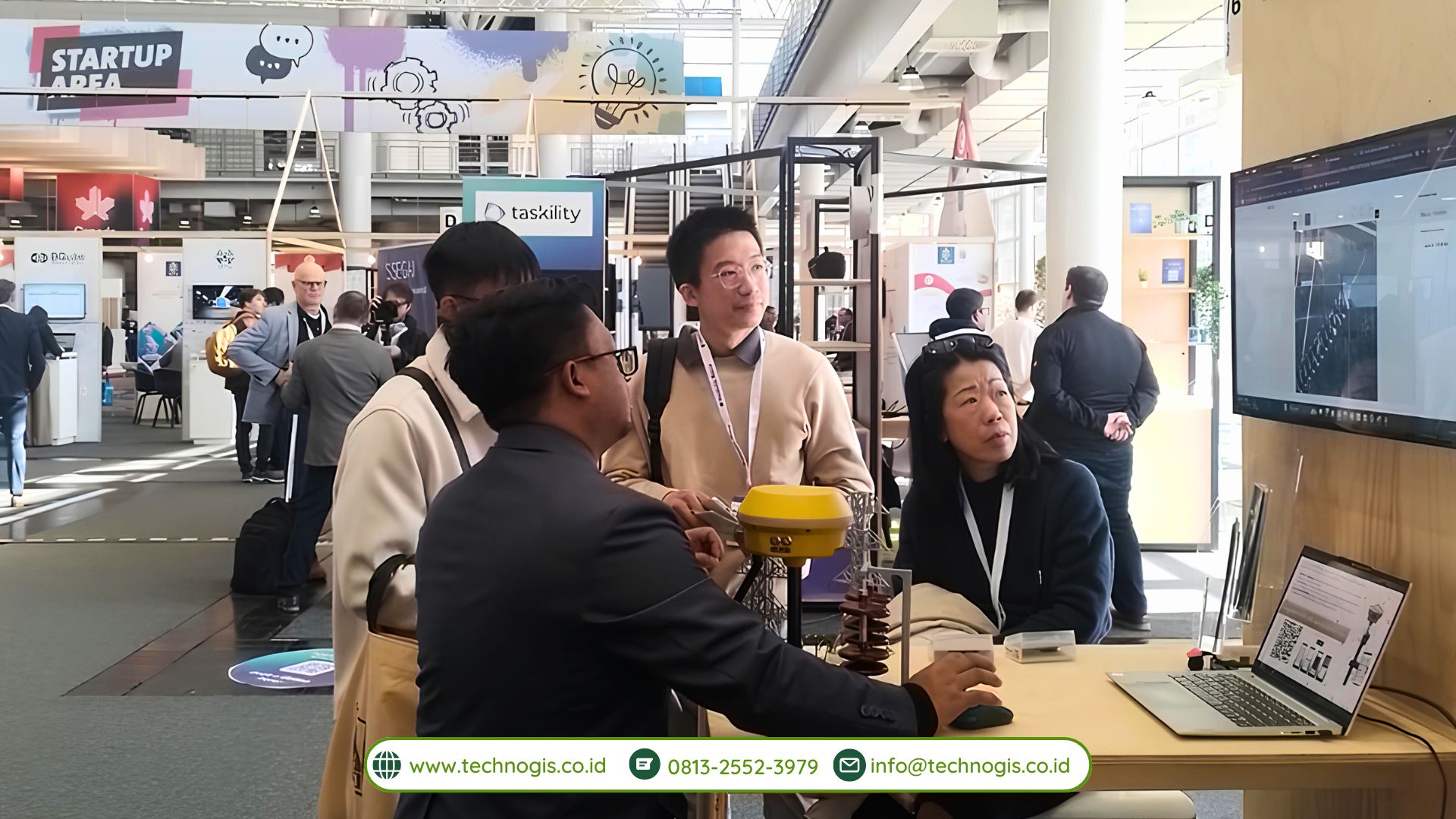
Hannover Messe is renowned worldwide as one of the largest and most influential industrial exhibitions, bringing together leading companies, startups, researchers, and government representatives from all corners of the globe. The 2025 edition of the event was no exception, serving as the perfect backdrop for groundbreaking agreements and initiatives. For PT Techno GIS Indonesia and Taskility, Hannover Messe provided the ideal stage to showcase their respective expertise in geospatial solutions and digital innovation, attracting the attention of potential partners and stakeholders worldwide.

Aligning Visions for the Future
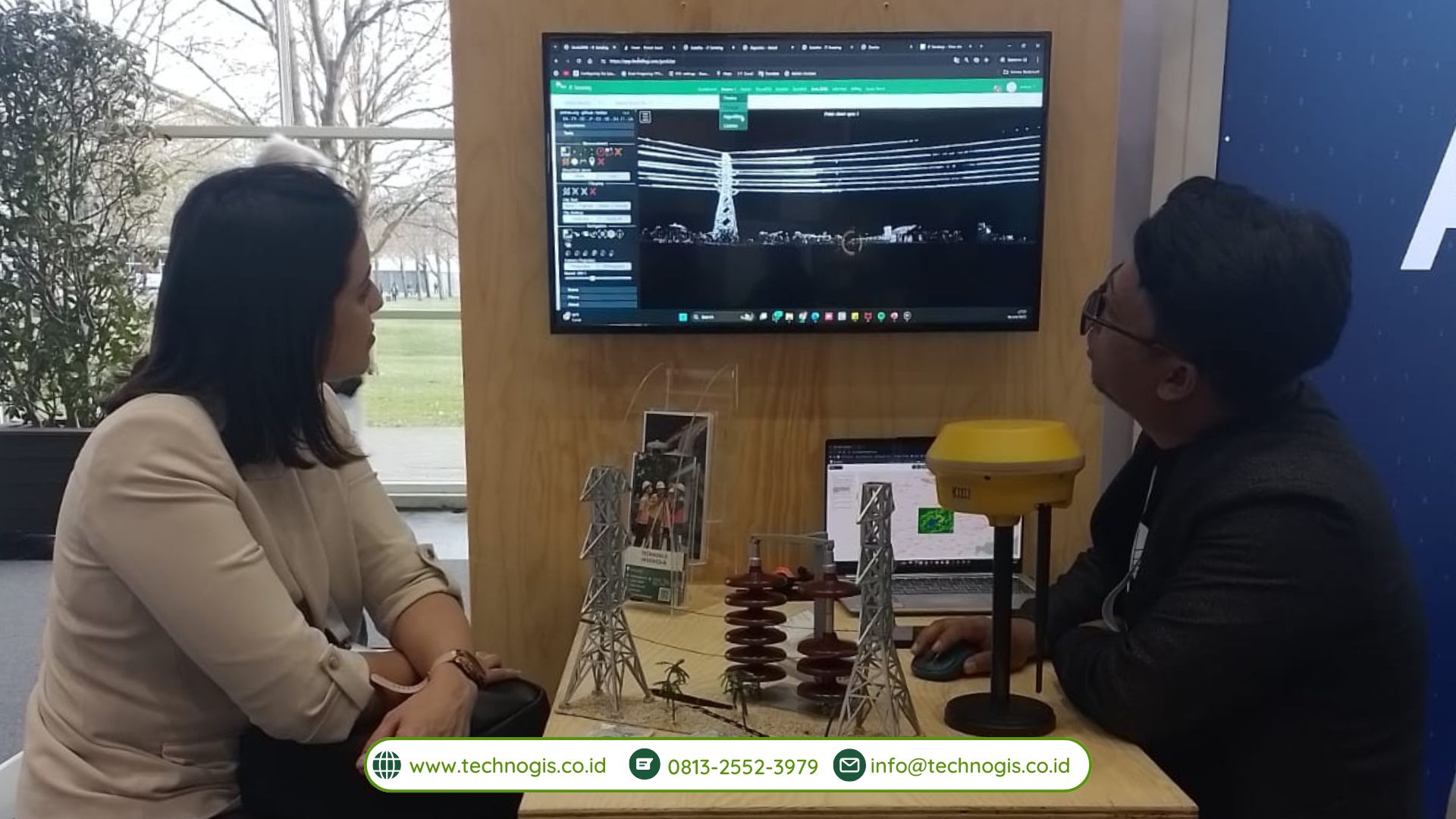
The key focus of this newly minted partnership is the development of advanced mapping technology solutions and the integration of cutting-edge digital innovation. By combining PT Techno GIS Indonesia’s extensive experience in geospatial data management, remote sensing, and geographic information systems (GIS) with Taskility’s prowess in digital transformation and process optimization, both organizations aim to reshape how mapping solutions are conceived and implemented in various sectors.

This collaboration was born out of a shared belief that, in today’s increasingly complex and interconnected world, innovation knows no boundaries. Through joint research and development, knowledge-sharing, and the pooling of resources, both companies seek to create impactful solutions capable of addressing the most pressing challenges faced by multiple industries—ranging from agriculture, urban planning, and logistics to disaster management and environmental conservation.

Bridging Continents: Indonesia Meets Mexico
One of the most notable aspects of this partnership is its international dimension, bridging two distinct yet promising markets: Indonesia in Southeast Asia and Mexico in North America. By leveraging each other’s regional expertise, PT Techno GIS Indonesia and Taskility anticipate broadening the reach of their innovations, tailoring solutions to the local contexts of countries in Asia and Latin America. This geographic diversity enriches the collaboration, creating opportunities for bilateral knowledge exchange, cultural insights, and, potentially, further commercial expansion into other regions.

Driving Global Digital Innovation
As part of the MoU, both parties have pledged to jointly invest in research projects that push the boundaries of mapping technology. The integration of artificial intelligence (AI), the Internet of Things (IoT), and big data analytics into geospatial platforms stands at the core of this effort. By deploying these emerging technologies, the partnership intends to create highly efficient, user-friendly, and scalable systems that can be adapted to multiple use cases.

Furthermore, the two companies aim to encourage innovation by conducting joint workshops and training sessions. These sessions will focus on enabling developers, engineers, and decision-makers—both from Indonesia and Mexico—to leverage advanced mapping tools effectively. The goal is not merely to build new software or hardware, but to cultivate a transnational community of innovators who can continue refining and implementing these tools well into the future.

Opening Doors to Collaborative Opportunities
This MoU also paves the way for exploring additional collaborations, particularly in academic research and government-led initiatives. Both PT Techno GIS Indonesia and Taskility recognize the importance of partnering with universities, research institutions, and government agencies to accelerate the development of pioneering mapping solutions. By pooling collective expertise and resources, the collaboration stands to benefit public-sector projects, such as infrastructure development and environmental protection efforts.

The Road Ahead
Though the MoU signing at Hannover Messe 2025 represents a significant accomplishment, both companies view it as a starting point rather than a final achievement. In the coming months, PT Techno GIS Indonesia and Taskility plan to establish dedicated working groups that will identify specific pilot projects and potential funding sources. Once these pilot projects are underway, they will serve as testbeds for evaluating newly developed systems and software, helping the partnership refine their approach before scaling up for broader deployment.

Looking forward, this alliance has the potential to not only transform how mapping solutions are generated and used but also reinforce the role of digital innovation in global industrial processes. By championing collaboration across borders and bridging expertise from diverse markets, the partnership highlights the value of international synergy in tackling technological and societal challenges.

A Milestone for Both Companies and Beyond
In summary, the MoU signing between PT Techno GIS Indonesia and Taskility at Hannover Messe 2025 is a testament to the strength of cross-continental collaboration and a shared vision for the future of mapping technology. It underscores their mutual commitment to fostering innovation, enhancing knowledge exchange, and advancing digital solutions on a global scale. As the partnership progresses, stakeholders in various industries will have much to gain from the anticipated breakthroughs that this collaboration promises.

Ultimately, Hannover Messe 2025 has provided the perfect platform for two forward-thinking companies to unite their respective strengths—geospatial know-how and digital transformation expertise—and chart an exciting path toward more intelligent, efficient, and sustainable mapping solutions. Through this MoU, PT Techno GIS Indonesia and Taskility are set to leave a lasting impact on the world of digital innovation and position themselves as leading figures in the rapidly evolving landscape of global mapping technologies.

PT Techno GIS Indonesia Signs an MoU with Aerial Intelligence at Hannover Messe 2025, Germany

Hannover, Germany – The Hannover Messe 2025 event once again witnessed the emergence of various innovative collaborations in the fields of technology and industry. One of the most significant moments of this grand event was the signing of a Memorandum of Understanding (MoU) between PT Techno GIS Indonesia and Aerial Intelligence, a German-based technology company. Through this MoU, both parties agreed to collaboratively develop aerial data-based solutions and strengthen their partnership in image processing and geospatial innovation powered by artificial intelligence (AI).

As the world’s largest industrial trade fair, Hannover Messe is known for bridging a myriad of ideas and innovations from across the globe. In 2025, the event adopted the theme “Industrial Transformation – Energizing a Sustainable Industry,” emphasizing the importance of merging technology and sustainability across all industrial sectors. In line with this spirit, PT Techno GIS Indonesia and Aerial Intelligence recognized the tremendous potential in harnessing aerial data and AI technology for various applications, ranging from agricultural land mapping, urban planning, disaster mitigation, to more efficient natural resource management.

One of the primary focuses of this MoU is the development of a comprehensive aerial data-based solution. Both parties are committed to designing systems for the collection, processing, and analysis of geospatial data that are not only reliable but also scalable. PT Techno GIS Indonesia, leveraging its extensive experience and local client base, will utilize its infrastructure and local expertise to gather field data. Meanwhile, Aerial Intelligence, through its advanced technology and R&D ecosystem in Germany, will provide an AI-based aerial image analysis platform capable of processing data quickly and accurately.

This collaboration also encompasses AI-powered geospatial innovations. Such technology is projected to help overcome various complex challenges faced by industries and governments, such as mapping remote areas, managing critical infrastructure, and identifying land cover changes. With the integration of AI, the developed systems are expected to generate predictive analyses, minimize data errors, and optimize resource utilization. These improvements are anticipated to have a positive impact across a range of sectors, including agriculture, plantation, forestry, mining, and urban planning.

The signing of this MoU is a strong symbol of PT Techno GIS Indonesia’s commitment to advancing geospatial technology in Indonesia. By partnering with Aerial Intelligence, the company aims to introduce sophisticated solutions that can stand up to global competition. In turn, Aerial Intelligence views this partnership as a gateway to penetrating the Southeast Asian market, particularly Indonesia, which has a significant demand for mapping and remote sensing technologies.

During the MoU signing at Hannover Messe 2025, representatives from both companies emphasized that this agreement is not merely an ordinary business collaboration; it is a synergistic effort to integrate two areas of expertise: the local knowledge held by PT Techno GIS Indonesia and the state-of-the-art technology of Aerial Intelligence on a global scale. The outcomes of this development are expected to be implemented in a more targeted manner, effectively addressing real-world needs.

Furthermore, the MoU opens the door for interdisciplinary collaborations. Various sectors, including academia and government, will be invited to work together to test and utilize the solutions emerging from this cooperation. This step is crucial to ensure that the innovations created truly have a high leverage effect on industrial development and sustainable growth.

In the near future, a joint team from PT Techno GIS Indonesia and Aerial Intelligence will initiate pilot projects in several selected locations in Indonesia. These pilot projects aim to test the integration of aerial data, image processing, and AI in addressing various needs, such as managing agricultural land.

PT Techno GIS Indonesia Successfully Completes Participation at Hannover Messe 2025, Germany

Hannover, Germany – PT Techno GIS Indonesia is proud to announce the successful completion of its participation in the prestigious international industrial event, Hannover Messe 2025, held in Hannover, Germany from March 31 to April 4, 2025. This participation has been a strategic move by the company to introduce cutting-edge geospatial-based technological innovations and smart digital solutions to the global market.

As one of the prominent representatives from Indonesia, PT Techno GIS Indonesia showcased an impressive array of the latest technological innovations and solutions. The company focused on digital mapping, remote sensing, geographic information systems (GIS), and drone technology tailored for the agriculture, forestry, and urban planning sectors. The Techno GIS booth garnered significant attention from international visitors, including representatives from global companies, investors, and potential partners from various countries.

During the five-day event, the team from PT Techno GIS Indonesia actively demonstrated flagship products such as a cloud-based spatial monitoring platform, a geospatial data management system, and an intelligent drone application that has been deployed in several key national projects. One of the highlight products was the smart agricultural drone solution, which is capable of conducting automatic mapping and precise field spraying, significantly boosting operational efficiency.

“Participating in Hannover Messe 2025 is a testament to PT Techno GIS Indonesia’s commitment to supporting digital transformation in the industry, not only in Indonesia but also on the global stage,” said the CEO of PT Techno GIS Indonesia. “We are immensely proud to demonstrate that homegrown innovations can be competitive and even excel on an international platform.”

Beyond exhibiting its innovative products, PT Techno GIS Indonesia also forged various strategic partnerships with international collaborators interested in developing geospatial-based solutions in their respective countries. The business discussions and networking sessions held during the event opened valuable avenues for expansion into global markets, particularly within Europe and Central Asia.

Hannover Messe is recognized as one of the world’s largest industrial trade fairs, bringing together industry professionals, technology innovators, business leaders, and research institutions from across the globe. This year’s event, themed “Industrial Transformation – Energizing a Sustainable Industry,” highlighted the critical importance of transitioning industries towards sustainability through technology and digitalization. PT Techno GIS Indonesia’s participation in such a high-caliber event underscored its role in the global drive toward industrial evolution and sustainability.

Moreover, the Hannover Messe experience served as a significant learning opportunity for the team. By engaging directly with leading figures in the global tech industry, the company garnered fresh insights into technological trends, international market demands, and potential collaborations that could further drive innovation. This enriching exchange of ideas not only deepened the team’s understanding of global market dynamics but also reinforced the company’s resolve to pursue continual technological advancement in the geospatial data field.

With the conclusion of Hannover Messe 2025, PT Techno GIS Indonesia returns home with renewed enthusiasm, a broader international network, and a determined vision to continue advancing spatial data technology in Indonesia. Looking ahead, the company is poised to innovate further and introduce solutions that remain relevant domestically while also being competitive on the world stage.

Hannover Messe has once again proven itself as a vital arena for fostering international cooperation and innovative breakthroughs. PT Techno GIS Indonesia’s active participation has not only elevated the profile of Indonesian technological prowess on a global scale but has also set the stage for future advancements that bridge local capabilities with global market demands. As the company moves forward, it remains committed to enhancing productivity and driving sustainable industrial transformation worldwide.